
Actionable geospatial intelligence
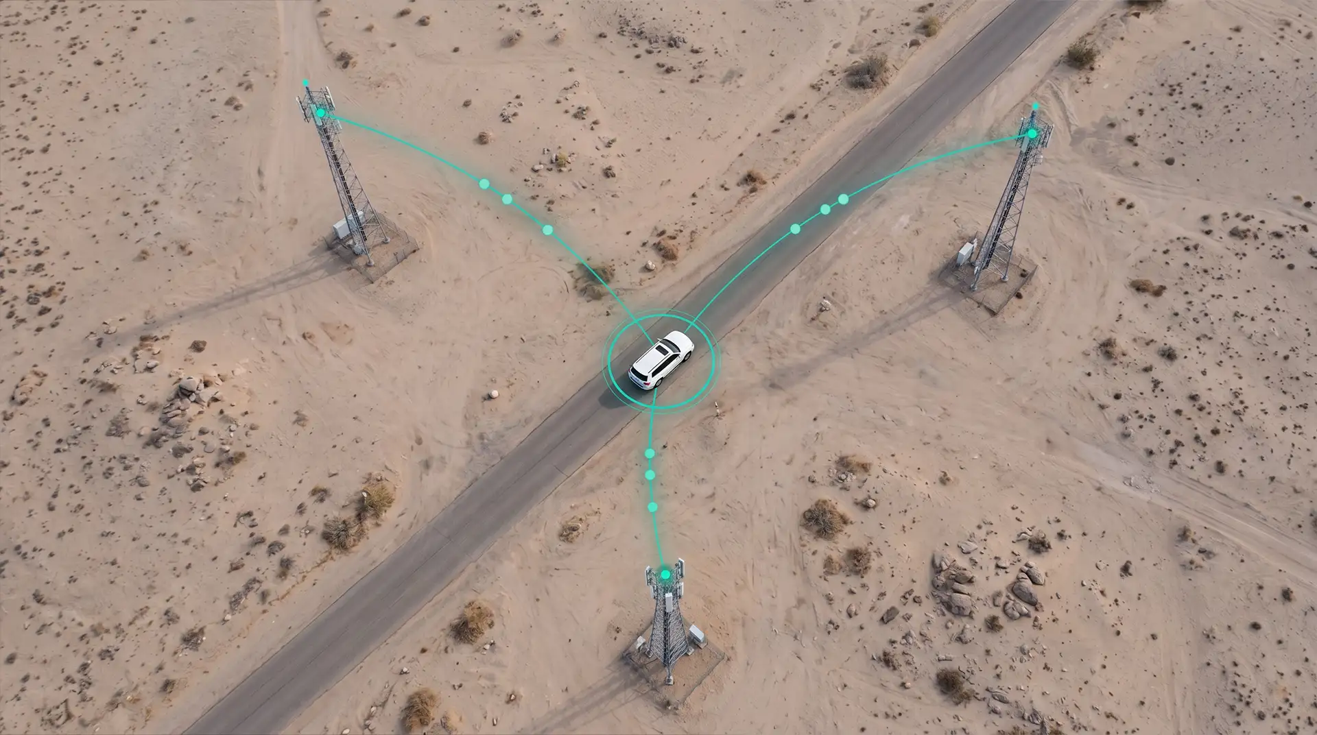
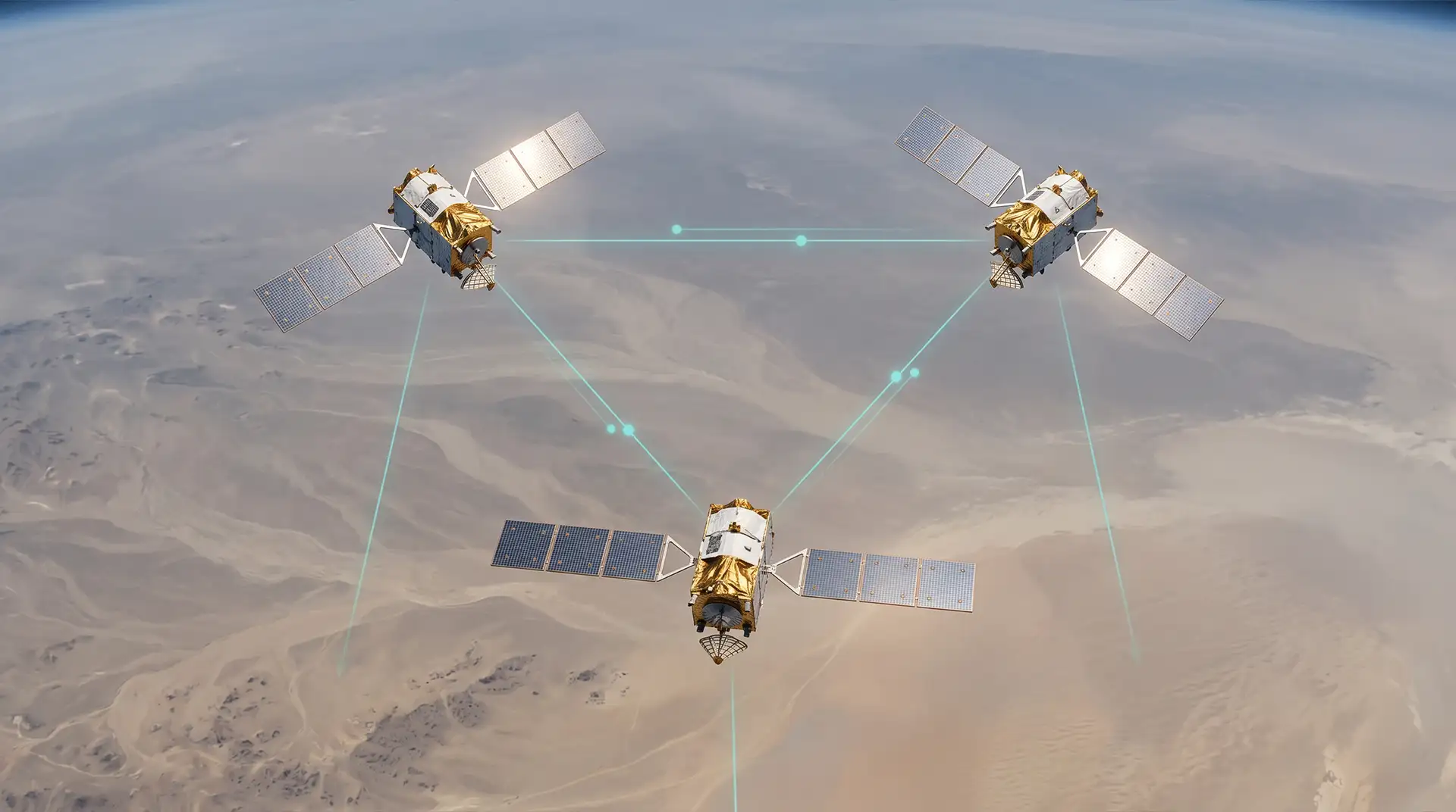
In the rapidly evolving landscape of 2026, mobile visual intelligence has shifted from basic recording to active, real-time understanding. By integrating advanced AI with multi-sensor data, mobile groups can now transform raw pixels into actionable geospatial intelligence.
Our Capabilities
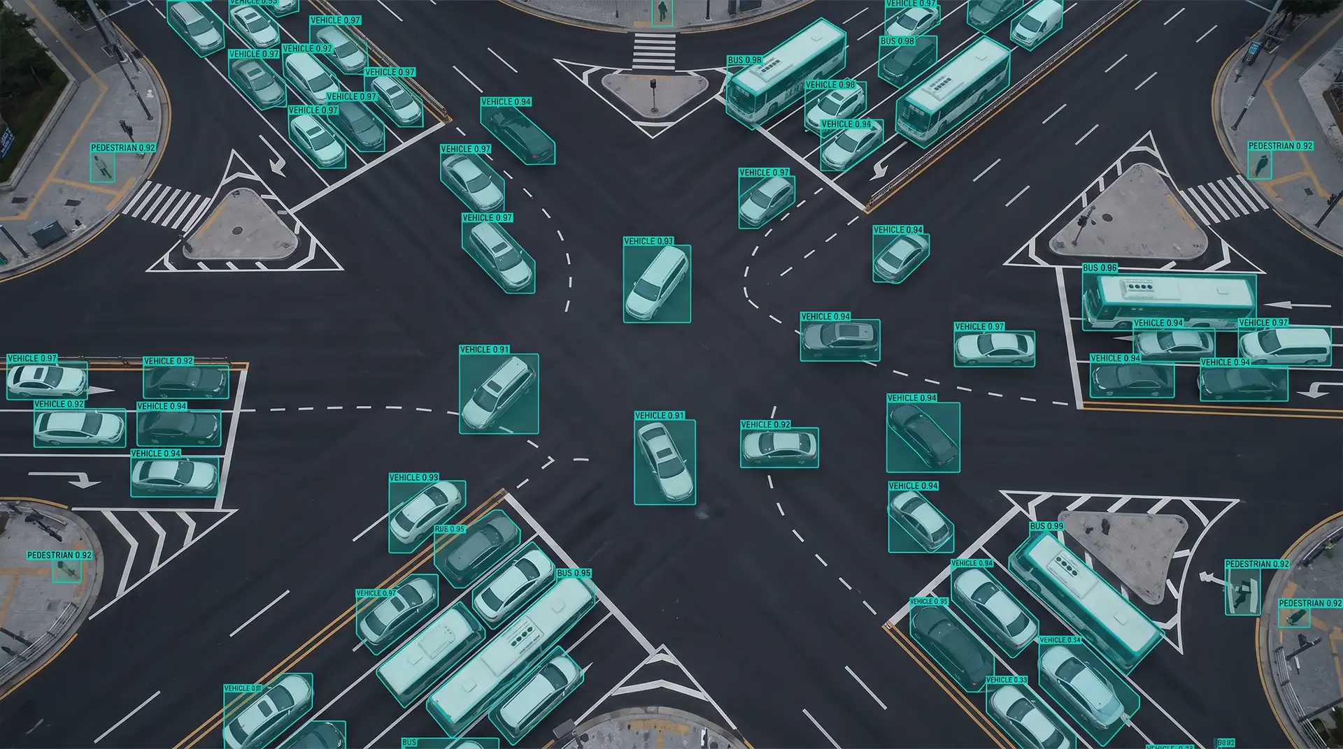
Object ID & Anomaly Detection: Beyond recording, our AI identifies specific risks like pedestrians or traffic signals and flags operational or mechanical deviations from established baselines.
Smart Mass Telematics: Engineered for large-scale operations, this capability processes thousands of endpoints simultaneously to provide real-time behavior scoring and a macro-view of fleet health.
Visual Predictive Maintenance: By fusing visual data with CAN bus telemetry, we forecast failures in high-wear components like tires and brakes before they become costly.
AI Training & Coaching: Our systems audit performance by tracking fatigue and aggressive maneuvers, creating data-driven modules for real-time safety corrections.
Big Data Fusion: We integrate disparate feeds—including satellite, drones, CCTV, and vehicle sensors—into a centralized ecosystem for a unified "ground truth" in decision-making.
.webp)